IPB University Researchers Develop Early Detection of Rice Damage with Proximal Sensing and Multisensor UAVs

Food agriculture is currently faced with increasingly complex challenges, one of which is global climate change. The phenomenon of climate change and the condition of in-situ ecosystems, including rice fields, continue to change from their natural conditions. This changes the spatial and temporal variability of paddy fields, especially at the site level.
Efforts to maintain food availability have been made in various ways including the establishment of Sustainable Food Agricultural Land (LP2B), subsidies, and insurance. Government subsidies are made for irrigation improvements for the provision of agricultural tools, chemical and organic fertilisers, seeds, and others. Agricultural insurance schemes are provided to farmers to continue producing rice food in the event of damage.
Despite these efforts, rice productivity challenges remain complex. The agricultural insurance scheme is provided through manual (conventional) damage assessment. The scale of damage is assessed based on plot area, samples are measured on the diagonal of the expanse of fixed observation plots, patrol models or roving with trap lights.
According to IPB University Professor at the Department of Soil Science and Land Resources (ITSL), Prof Baba Barus, this approach is still subjective based on the ability of field officers who can have different interpretations. In addition, the time required is long, the number of people working with the allocation of observation time on a large scale is expensive, and the accuracy of the results of determining the scale of drought is also still biased.
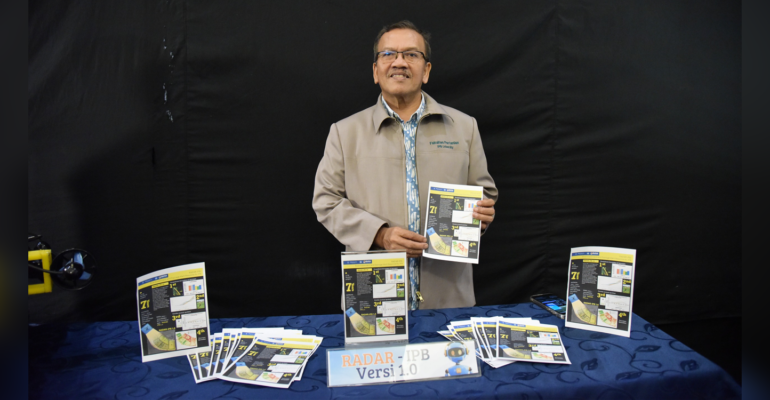
Responding to the need for objective, rapid, and spatial damage assessment, Prof Baba Barus and a team from the Department of Plant Protection (PTN) and the Centre for Planning and Regional Development Studies (P4W) developed RADAR-IPB: Rice Assessment and Damage Alert Response by IPB 1.0. This model is a development of version 1 to detect anomalous spectral patterns of rice damage that have an impact on reduced productivity.
“RADAR-IPB 1.0 uses proximal field measurement tools and Multispectral UAVs (Drone Multisensor) to understand the spectral patterns of rice plants with dry, wet, and normal conditions with IR 64 and Ciherang rice varieties,” said Prof Baba Barus.
He explained that the assessment of rice damage follows the official assessment method, and is carried out from planting to harvest (9 times) and simultaneously with drone data collection. From the observation of the spectral value of field sample measurements, the resulting plant spectral changes rapidly according to environmental conditions, and in general certain plants are more sensitive to damage due to bacterial leaf blight.
He further explained, the incidence of damage began to occur in the vegetative phase at the age of 35-40 days and there was a noticeable change in the generative phase at 60 days and also 75 days, after which the damage was constantly increasing. From this data, to prevent damage in the final phase, it is necessary to take early action for damage below 20 per cent at a certain phase, which is located at around 75 days of age. To consolidate damage prevention further, early detection is recommended in the phase before 60 days of age, where damage is around 15 per cent.
The Proximal Sensing information is then used for drone selection, which results in a damage map. The damage map was created using the Maximum Likelihood Classification (MLC) method, considering that it has good accuracy, is easy to do, and is widely available in software. Other mapping was also done, such as vegetation index-based or other variations, but the results were not better than MLC mapping. Damage maps were made in several measurements to see the potential speed of change of the damage area.
“In this study, damage mapping was made at 60 days after planting (HST) and 75 HST. There was a noticeable change within 15 days where the damaged area increased by more than 200 per cent. The area of low-grade damaged rice (6-12 per cent) increased greatly. The incidence of damage in the generative phase is ideally prevented in the vegetative phase,” he explained.
This model, he continued, also produces information on the spread of damage early, which can be used to see the tendency of the spread of damage which turns out to be specific to the environment and varieties.
“RADAR-IPB version 1.0 has produced this detection model through early prediction of damage from spectral patterns and determination of temporal early damage maps, which show the need for various parameters and processes to prevent rice damage in the final phase,” he said.
This new method of rice damage assessment is part of the research consortium activities of the Chiba University team with the IPB University team (including Udayana University, West Java Provincial Government, and Badung Regency Government). The research makes extensive use of multisensor remote sensing (optical, and SAR satellite imagery, as well as UAV drones) and geospatial data.
Through a research consortium funded by Science and Technology Research Partnership for Sustainable Development-Satreps, the method has assisted agricultural insurance assessment and training has been conducted to field officers from 11 provinces, namely North Sumatra, Central Java, West Java, Riau Islands, Lampung, Banten, South Kalimantan, South Sumatra, Yogyakarta, East Java, and South Sulawesi. (IAAS/RUM)


