IPB Prepares Recommendation to Improve National Rice Data
In order to obtain rice productivity data and land area or harvested area, the Central Statistical Agency (BPS) and the Agency for the Assessment and Application of Technology (BPPT) conducted a study and implemented an Area Sample Framework (KSA) approach, namely the technique of sampling approach that uses the land area as an enumeration unit. This system is based on geographic information system technology (GIS), remote sensing, information technology, and statistics to obtain data and information on food crop agriculture, especially rice.
The KSA approach is expected to be able to answer the provision of accurate and timely data and information to support the planning of the National Food Security Program. However, the publication of the study results based on the KSA has made a “chaos” of national rice data because there have been significant differences between the data from the publication of the Ministry of Agriculture and data from BPS publication.
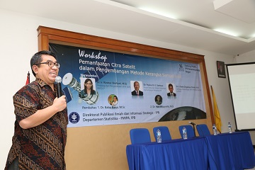
To answer this challenge, three work units at the IPB University, namely the Department of Statistics, the Directorate for Scientific Publication and Strategic Information, and the Institute for Research and Community Service (LPPM) of IPB University, tried to initiate a study of these problems. One of them was by holding a Workshop on the Use of Satellite Imagery in the Development of the Area Sample Framework Method, at the IPB Baranangsiang Campus, Bogor (03/16). In this workshop, it was revealed that a synergy is needed from each relevant agency to work together in improving national data, especially on national rice production. It is necessary to formulate recommendations to the government to improve national rice data and to conduct another workshop with resource persons from all related agencies in Indonesia.
In her presentation, Dr. Rizatus Shofiyati, a resource person from Pedology and Remote Sensing of the Center for Agricultural Land Resources (BBSDLP), said that if two methods are used, remote sensing with the KSA method can be integrated so the results of the observations will be very good.
“Remote sensing is used to identify and monitor agricultural crops to bridge many things. It has been used to obtain rice data in 2012. This year BPPT is requested to do remote sensing for corn. BPS asks for 100 percent accuracy,” she said.
According to Dr. Rizatus, there were 99.22 million hectares of potential land for agriculture (2015 data). Approximately 70.59 million hectares of 144.47 million hectares of land available were on dry land. There were 9.44 million hectares in non-swamp wetlands and 19.19 million hectares in swamps (of 34.12 million hectares available). Existing agricultural land in 2017 was 7.10 million hectares of rice field area (correction from BPS, 2018), 11.73 million hectares of plantation land, and 5.22 million hectares of field. While there were 12.02 million hectares of no cultivated land and 25.85 million hectares of plantation land (annual crops).
Meanwhile, according to Dr. Paulus BK Santoso, from the Data and Information System Center of the Ministry of Agriculture, said that in order to obtain fast and accurate data and information on rice production, the obstacles that are often faced so far are the calculation of harvested area, especially rice, using methods that are considered less scientific, data accuracy of harvested area that has not been measured, and harvested area data which is allegedly less objective and over estimate.
“BPPT and BPS have developed the KSA method to calculate the rice harvested area. However, there is still an obstacle for tracking because the location is unreachable and uncharted. Moreover, there is also a problem in the device such as GPS, The signal is constrained so that the image is not recorded and cut off. For example, the initial square shape of the result becomes a triangle, which finally reduces the area,” he added.
From the results of this discussion, Dr. Anang Kurnia, Chair of the Statistics Department of IPB University, concluded that this discussion forum was expected to contribute to the improvement of KSA being used by BPS for estimating rice. This discussion was to find out how the role of satellite imagery is used in developing the KSA method.
“Several workshops involving various parties such as BPS, Ministry of Agriculture, BPPT, and Geospatial Information Agency (BIG), will be carried out to obtain accurate information from the methods currently used including the KSA method. The Statistics Department of IPB University will involve a team of remote sensing researchers, IPB-LAPAN satellite data researchers or managers, and other related parties,” he said. (dh/zul/ZSP)