IPB University Postgraduate School PSL Study Program Invites World-Class Professors from Japan to Discuss Remote Sensing
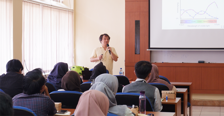
The Study Program (Prodi) of Natural Resources and Environmental Management (PSL) Postgraduate School (SPs) IPB University is holding a Studium Generale by World Class Professor (WCP) in 2023 in the Situ Cikaret Room, Baranangsiang Campus. The studium generale presented Prof Satoshi Tsuyuki from The University of Tokyo with the theme ‘What is Remote sensing? ‘And It’s Application to REDD+ in Tropical Forest’ was attended by 53 PSL study program members and Dr Syartinilia, Secretary of PSL SPs University master’s program as moderator.
The WCP 2023 program is a program from the Indonesian Ministry of Education, Culture, Research and Technology (Kemdikbudristek) in order to accelerate the achievement of the target number of international publications in 2024. This program aims to invite world-class professors from various well-known domestic and foreign universities as visiting professors. They will be placed in various universities in Indonesia. At the same time, Indonesian researchers were also sent to visiting professors’ home institutions, one of which was Dr Syartinilia, a lecturer at IPB University who was sent to The University of Tokyo.
“The WCP 2023 program is intended so that lecturers and researchers can interact with well-known and superior professors, so as to be able to improve academic life, competence, quality and contribution to the development of science and technology (science and technology) and strengthening the national innovation system. In addition, the achievement of the main tertiary performance indicators (IKU) is also the output target of this activity. This program focuses on mandatory outputs, one of which is joint publications in reputable international journals (Q1),” said Dr Syartinilia.
Prof Satoshi Tsuyuki explained that remote sensing has many advantages in seeing the land cover condition compared to other methods, such as ground checks. Remote sensing is more effective and efficient in terms of time and also the area being monitored. “However, remote sensing also has weaknesses, namely that it cannot detect land use or land use,” he added.
He added that the way remote sensing works is largely determined by the reflectance or reflection of objects to be identified. Each object has a different spectral reflectance, even though it is difficult to distinguish by the naked eye. The condition of cloud cover, climate and pollution of an area can affect remote sensing results. “To get the best results, it is necessary to take aerial photographs with minimal cloud cover,” he added.
Prof Satoshi Tsuyuki explained that the focus is on the application and application of remote sensing in tropical forests, one of which is Light Detection and Ranging (LiDAR), which can be used to assess biodiversity in natural forests. “One of the outputs from using LiDAR is obtaining a Normalized Difference Vegetation Index (NDVI) value,” he explained.
In the 2023 WCP Program series in Indonesia, Prof Satoshi Tsuyuki then gave material at the Department of Landscape Architecture, Faculty of Agriculture IPB University and IPB University’s Directorate of Global Connectivity. (HBL/Rz) (IAAS/MFR)